Distinctive “Area Safety Map” by Shiga Prefecture Which Also Visualizes the Risks of Rainfall Inundation
| Date of interview | October 26, 2020 |
|---|---|
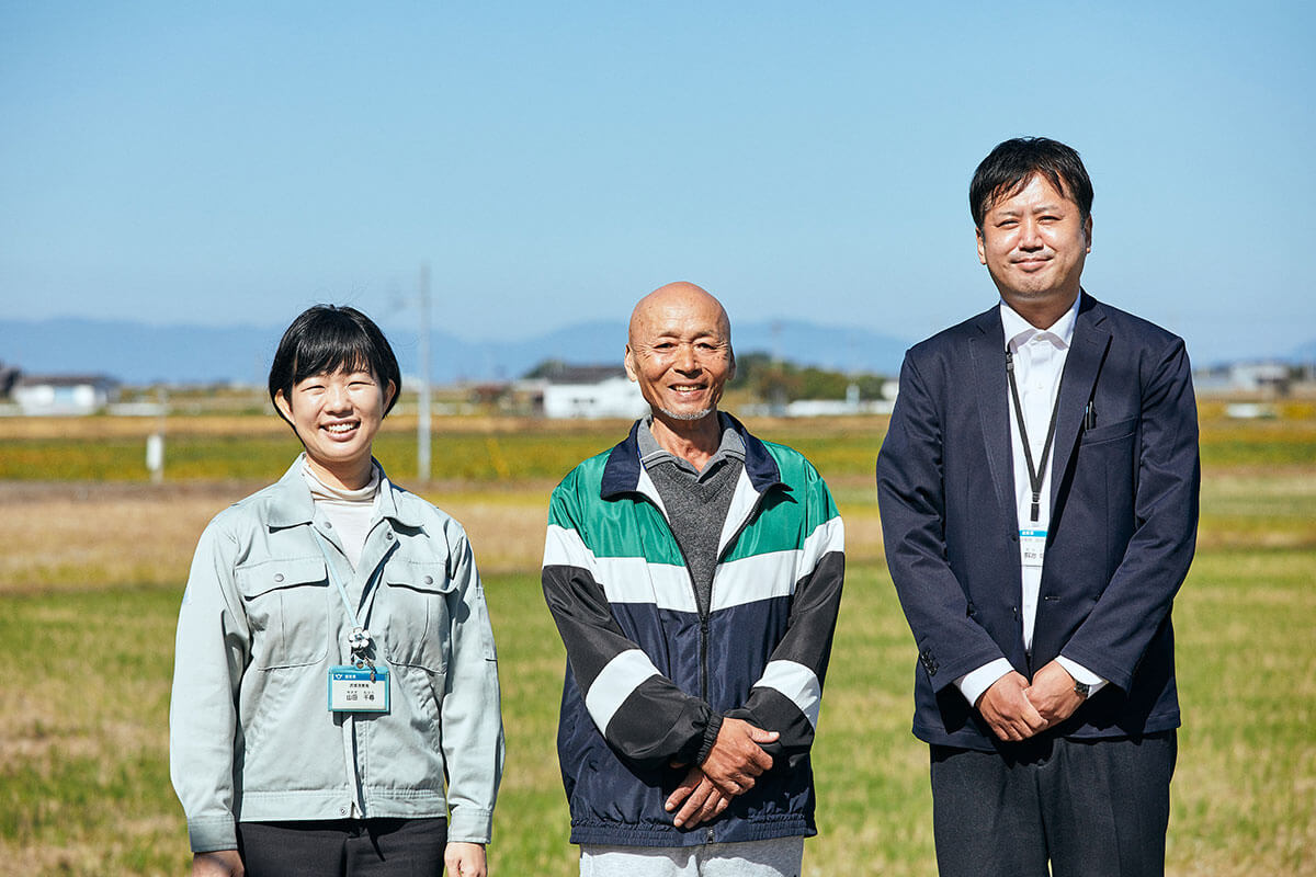
| Targets | Flood Management Second Section, Flood Management Office, River Basin Policy Bureau, Department of Public Works and Transportation, Shiga Prefectural Government Chihiro Yamada, Senior Manager and Section Chief Tomohiko Kaneko, Planning Chief Shiota Kaji, Senior Technical Staff Noriaki Oda, Disaster Prevention Manager, Kinugasa Joto Residents’ Association, Kinugasa Town, Higashiomi City |
Please give us an outline on the basin-wide flood management Shiga Prefecture has worked on.
Ms. Yamada: When river improvement has not progressed in Shiga Prefecture before, small inundations occurred frequently, and residents lived with awareness that this is an area where flood damages occurred to some extent. Later, the frequency of flood damages decreased as river improvement advanced. This was a good thing, but at the same time it led to an issue that the sense of danger might fade away from the residents’ mind.
In other prefectures, there were cases in which heavy rainfall of an unexpected scale occurred and caused flooding even when river improvement and dam establishment had been done properly, and in which evacuation to save lives resulted conversely in accidents.
Based on these, we reached the conclusion that the measures in rivers alone that the administration has implemented so far were not enough to protect the lives of the prefecture residents, and that flood management must be implemented while including measures outside the rivers. The Flood Management Office was therefore established in September 2006.
We first launched an administrative subcommittee to discuss with organizations within the government office and municipalities, public meeting, expert subcommittee, etc. to consider what measures might be required, then prepared the Shiga Prefecture Basin Flood Management Basic Policy in March 2012. To make this basic policy effective, an ordinance on promotion of basin flood management in Shiga Prefecture was put to vote in prefectural assembly and proclaimed in March 2014. Currently, we are promoting various efforts to protect life from flood damages based on the ordinance.
Please tell us about the history until the publication of the “Area Safety Map” and its characteristics.
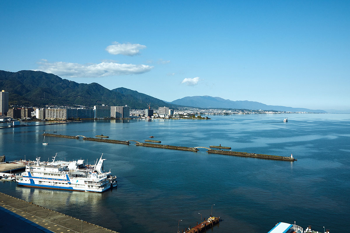
Ms. Yamada: Inundation occurs in two stages. One is rainfall inundation, in which the water channels and small and medium rivers in town overflow, and the other is river water inundation, in which large rivers overflow as rain continues. In Shiga Prefecture, we also have another type of flooding, which is the rise in water level in Lake Biwa, which occurs roughly 1 day after the peak of rainfall.
For flooding of large rivers, etc., a flood and inundation assumed area map is prepared by each prefecture based on the Flood Control Act. It illustrates the inundation range and depth when a river overflows in a figure, and the flood and inundation assumed area map is prepared for Lake Biwa and 15 rivers in Shiga Prefecture.
While these can show the flooding risks near large rivers, it is impossible to consider the necessity of evacuation, locations to evacuate to, or timing of evacuation, or protect the lives of many prefecture residents unless we visualize the flooding risks of small to medium rivers and channels. It was the “Area Safety Map” that was therefore created. This was the first attempt in the nation. It was first published in September 2012, and updated in March 2020.
Did you employ any creative efforts, and did you face difficulties?
Ms. Yamada: The “Area Safety Map” models everything including the height of embankment and elevation of each river and road, and simulates the water flow when there is uniform rainfall. It also takes into consideration the phenomena such as one in which the downstream flow changes when water overflows from a river at an upstream point, so that the results would be closer to the actual conditions.
It also shows the inundation risks from heavy rainfalls that occur at the probability of once in 10 years, once in 100 years, and once in 200 years. While the technical advice from the national government says it is not desirable to incorporate areas where inundation above floor level may occur with hourly rainfall of approximately 50 mm into urbanization areas, it is normally difficult to determine which areas apply as such. However, the map for 10-year probability is calculated for maximum hourly rainfall of 50 mm, and it shows at a glance which areas will have inundation above floor level. It became possible to help in urban development by specifying an ordinance not to include such areas in urbanization areas, etc.

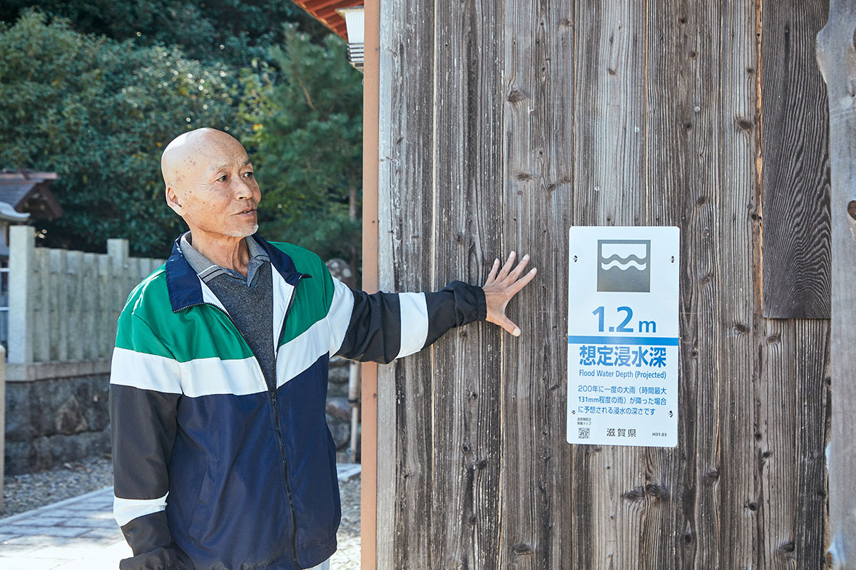
On the other hand, considerably heavy maximum hourly rainfall of 131 mm is assumed for the 200-year probability, and the purpose of this is to utilize the data to protect lives. For areas with inundation risks of 3 m or higher, we examine preparation of evacuation plan and safe ways of living with the residents of the areas, then specify them as inundation warning zones, which are stipulated in the ordinance, and ask the residents to create evacuation spaces above the inundation line when they rebuild their houses, etc. Both cases are examples that ensured secure operation by establishing an ordinance.
What measures is Shiga Prefecture considering while it is expected that climate change will advance further in the future?
Ms. Yamada: Although we are not certain how much is the impact of climate change, it is statistically evident that hourly rainfalls of 50 mm and higher have increased all over the nation, and that they have increased considerably when we compare years 1980 and 2010.
Under such circumstances, we are comprehensively implementing as basin flood management of Shiga four types of measures, which are the measures to “discharge” flood water safely by river improvement work and proper maintenance, measures to “prepare” for flood damages in cooperation with the local residents through map training, preparation of evacuation plan, disaster prevention training, etc., measures to “store” by storing or permeating the rainwater in playgrounds, forests, agricultural lands, etc., and measures to “minimize” the damages through raising the embankment for residential areas and land utilization guide.
To work on such measures while using the “Area Safety Map” assuming rainfalls once in 10 years, 100 years, or 200 years as the basic information has led to considerable preparations for climate change.
Do you have any advice to other municipalities that wish to use the efforts of Shiga Prefecture as reference?
Mr. Kaneko: As Ms. Yamada mentioned the four types of measures earlier, what is most important is the measure to be prepared, and the understanding by the residents. There are many things that will not help if only the administration knew, such as the inundation risks, locations of evacuation, the timing to evacuate in case something happens, etc. in the area of residence. It is also extremely important that each person chooses the actions to save lives and ways to live safely.
However, some people still have the reaction “I have never heard of this area having such risks,” and make us realize how difficult this is. I feel that the approach to think with the residents to make sure they understand is necessary.

Ms. Yamada: Because Shiga Prefecture has suffered few large flood damages since 2014, it is natural that people feel “I cannot believe such thing could really happen” when we show them the map of 200-year probability rainfall. However, a heavy rainfall that has never been seen occurs somewhere in Japan almost every year, and results in many deaths.
A society which does not lose any life to flood damages or sediment disasters cannot be achieved in a single day, and we do not think there is an end to the efforts of disaster prevention. I consider that the best way to protect as many lives as possible is to start from what we can do by combining various measures.
Please tell us the efforts of Kinugasa Town, Higashiomi City, which is designated as a priority region by the prefecture, against disasters in cooperation with the prefecture.
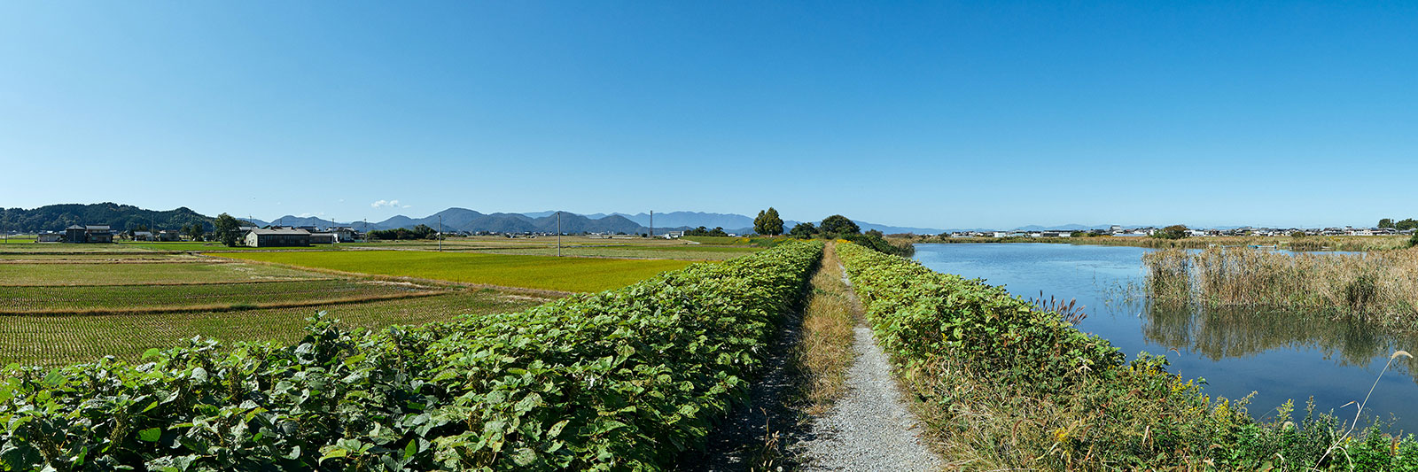
Mr. Oda: It has been 75 years this year since people settled in this area. After the war, the rice paddies in this area were offered free of charge for the purpose of increasing the production of rice, and people came from all over the country. Then an area that used to be a part of Lake Biwa was improved as a reclaimed land to expand the field. They built their own houses and lived while growing vegetables and rice. We have a strong impression of a barrack shed, which had been used as a residence, collapsed in the 1959 Ise Bay Typhoon and the Daini Muroto Typhoon in 1961.
After the Great East Japan Earthquake in 2011, personal interests grew about how we should evacuate if there was an earthquake. When I was appointed the chairperson for the residents’ association of this town in 2014, I launched a disaster prevention subcommittee after thinking about what I could do as prevention measures against disasters including flood damages. At first, I did not know what to do, but then the “Shiga Integrated Flood Management Ordinance” was issued in March while I was having discussions with others. I thought that the flow of measures in the “development plan for communities that are resistant to flood damages and sediment disasters” that the prefecture was trying to promote could also help develop the disaster prevention activities of our area. We have therefore asked for cooperation of the Flood Management Office, and implemented measures in stages, including map training, check on actual sites, and check on evacuation routes.
We have done some significant work by collecting opinions and impressions from the participants and double-checking the dangerous points in our area. We were able to prepare our own disaster prevention map through map training. It has been 6 years of steady work wishing to raise the residents’ awareness of disasters even by a little through these activities.
Ms. Yamada: The residents’ association of Mr. Oda has a high rate of attendance in map training, and had high solidarity as everyone knows everyone else in their everyday life. Their understanding of the Shiga Integrated Flood Management Ordinance is also high, which allowed us to implement the measures with cooperation from an early stage after the issuance of the ordinance, and the area was designated as an inundation warning zone in 2020.
Can you each tell us briefly about the sense of satisfaction in your current work, and your future prospects?
Ms. Yamada: The purpose of the ordinance is to protect the lives of people above all things. The next one is to protect the assets from damages that would make it hard for people to rebuild their lives, such as inundation above floor level. I feel the sense of satisfaction in my work, where I can act toward such clear goals. I feel very happy to be able to help protect the lives of the people in the community, including getting a request for being a lecturer on demand at elementary schools and community meetings.
However, they may not know what kind of evacuating actions to take by only publishing the “Area Safety Map” and transmitting the flood damage risks, and they may find it difficult to utilize the information on the “Area Safety Map,” which we are definitely promoting when they rebuild their houses, etc., unless there is specific advice for preparing for flood damages.
I hope to continue approaching the residents so that we can continue to provide such support to prepare for water damages and so that they can live safely in Shiga by cooperating with the people of the community and the municipalities.
Mr. Kaneko: While the municipality often takes the initiative in such efforts for evacuation actions of the community, I feel the sense of satisfaction in being able to implement these in cooperation among the prefecture, municipality, and residents.
Mr. Kaji: Last fiscal year, I was in charge of updating the “Area Safety Map.” The “Area Safety Map” can be used to check the assumed inundation depths including both river water inundation from large rivers and rainfall inundation from small channels, etc. I truly feel that I am involved with an effective tool to transmit the flood damage risk to the prefecture residents.
Mr. Oda: That I keep getting the solid sense that the awareness of people on disaster prevention is improving by persisting year by year is one of the things that gives me the sense of satisfaction. I feel that I was able to continue because we were able to step up little by little, including bringing the disaster prevention map into shape through map training and walking through town.
What I worry about is the aging of the community. We still do not have a perfect method when we think about how to protect their lives in case a large disaster occurs. Although we have prepared the help map that states the locations of people who require support and the division of roles for the people who are to go to help in case of emergency, we never know what kind of disaster may happen and when. It is difficult to force evacuation training on those who require support, and this remains an issue for the future.
Ms. Yamada: Since circumstances vary by the community, I hope to find a suitable method for each. Cooperation between disaster prevention and welfare is a large issue over the country, and our prefecture has launched examinations and efforts with cross-cutting cooperation among the organization within the prefectural government.
Related website:
(Date of publication: February 1, 2021)
